

"Web-Based Flood Simulation Search System at an Arbitrary Point" (Flood Navigation System) is a system that displays a flood estimation area chart on a digital map.
「Web-Based Flood Simulation Search System at an Arbitrary Point」
Presently the process of collection of the flood simulation data is still underway, so the search only works for a limited number of areas.
The number of areas available will be steadily expanded from now on. Click here for the rivers, which can be presently searched.
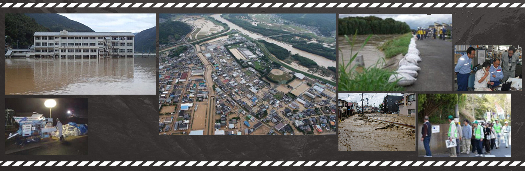


To keep the damages caused by floods to the minimum, firstly there is a need for each and every resident as well as companies and other entities to understand in ordinary times the risks and damages that can be caused by floods, and secondly and most importantly to have information about the places that become dangerous at the time of floods.
The Ministry of Land, Infrastructure, Transport and Tourism(MLIT) and governments of all prefectures announce information regarding the areas, which are assumed to be flooded if a neighboring river overflows, as well as regarding the depth of water assumed to accumulate in such areas when they are flooded. This information is presented in the form of flood estimation area charts.
Finding the estimated flood levee failure points
Here you can see which points of which river, if the levee breaks down (flood levee failure) will flood the area where your house stands or your company is located.

Finding the estimated flood scale
Here you can see in the form of animation and graphs which areas will be flooded, when they will be flooded, and how high the water can go if the levee breaks down (flood levee failure).
Finding the estimated flood scale for pluvial flooding and floods due to high tide
This section shows the range of the pluvial flooding and flood due to high tide.
Finding the river's water level information
This section shows which water level observation points you need to get information from in the case of heavy rains. It also has links to homepages with the current water levels.
Using this information you will be able to get an idea of how extensive the flood will be, at what time it will begin, after how many days the water will subside, etc. if a levee breaks down (flood levee failure). You can also use this service to collect other information such as on whether river waters have reached a dangerous level.
We hope that by using the service you will be able to enrich your understanding of the flood damages that can happen in the area you live in beforehand and utilize the knowledge for flood prevention activities, evacuation, etc.
Supported IE11, Firefox, Google Chrome, or iPhone and Android pre-installed browsers.
Click here for questions regarding the conditions of the simulation.
<Contact for inquiries regarding functions or operations of the system>
Geographic Department, Geospatial Information Authority of Japan, Ministry of Land, Infrastructure, Transport and Tourism
Please use the inquiry form here if you have any questions
Banner
Feel free to use the system's banner below.