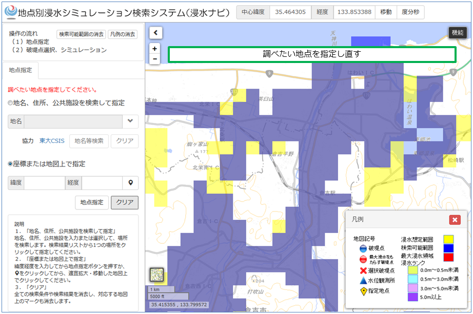

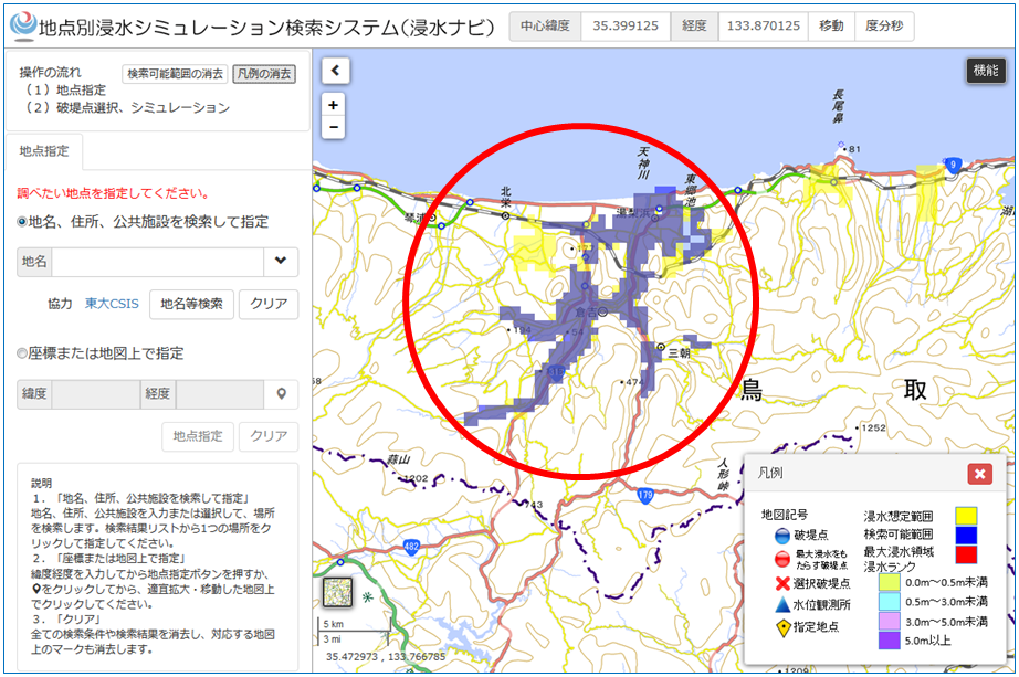
Areas, for which flood estimation area charts are already made, are marked yellow on the map.
Areas that can be searched using the Web-Based Flood Simulation Search System are marked blue on the map. The areas are for reference purposes only and some parts of the marked areas may not be searchable. These areas that are not searchable will be unmarked when the map is magnified.
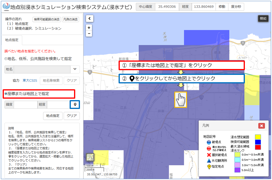
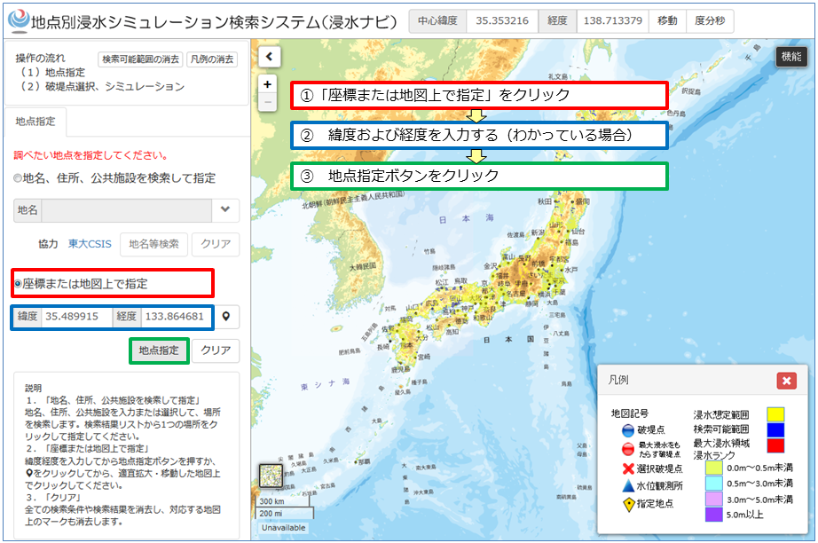
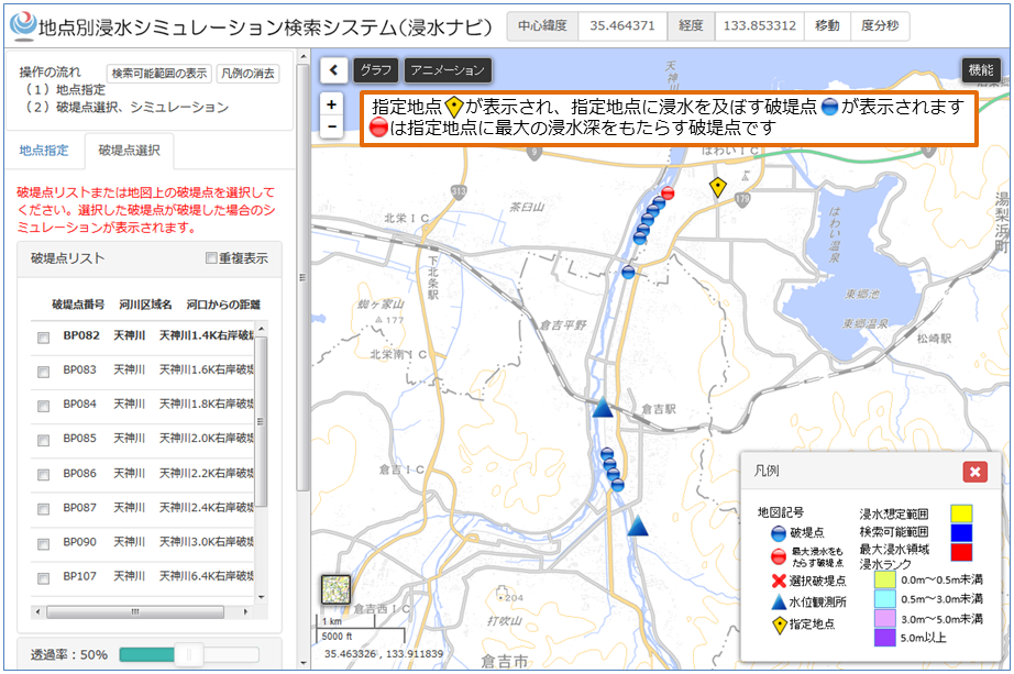
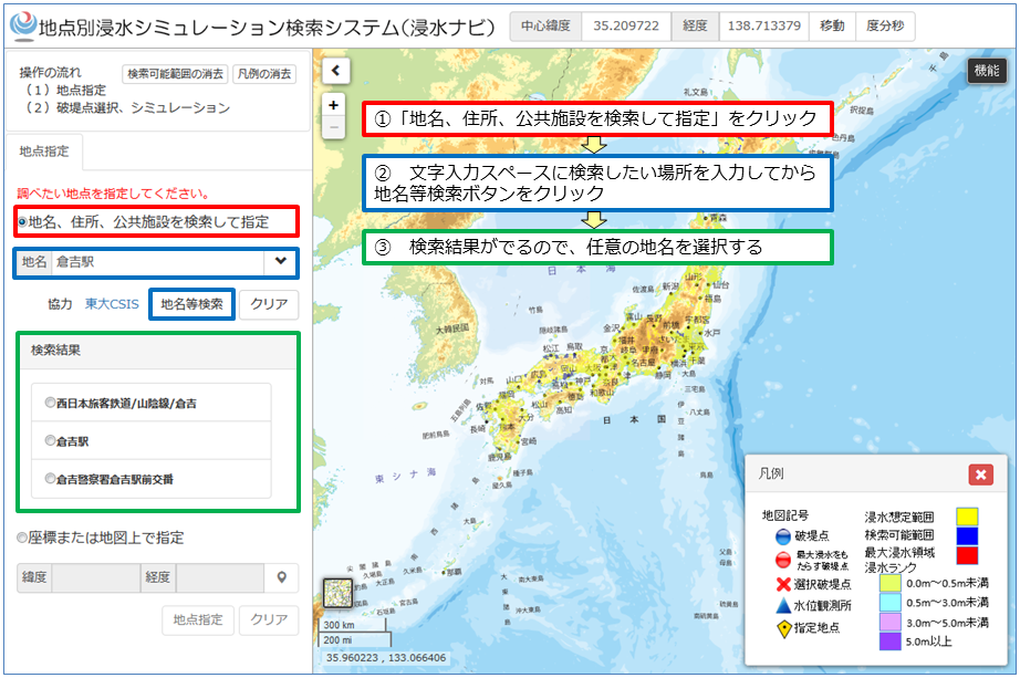
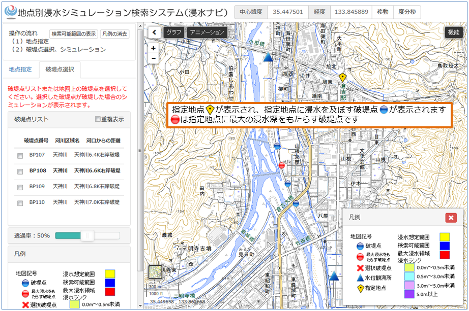
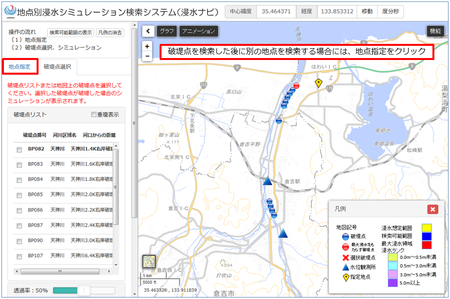
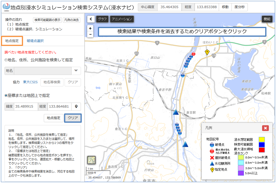
There are three ways to find the estimated flood levee failure points.