Finding the estimated flood scale<Instructions>

Here is how you can find the estimated maximum flood area and changes of water levels (with graphs and animation)

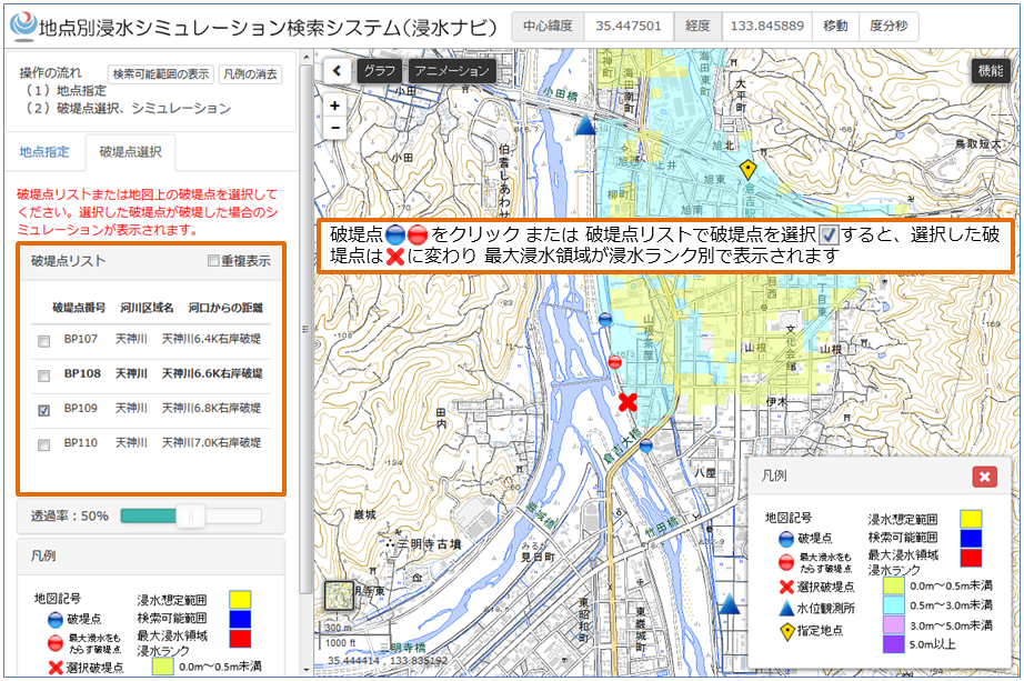
Display of the estimated maximum flood area of a levee failure point.

Display of the estimated maximum flood area of a levee failure point.

Display of the flood simulation graph

Display of the flood simulation graph

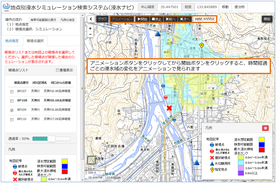
Display of the flood area animation

Display of the flood area animation


<Contact for inquiries regarding functions, operation, etc. of the system>
Geographic Department, Geospatial Information Authority of Japan, Ministry of Land, Infrastructure, Transport and Tourism
Please use the inquiry form here if you have any questions